The Philippines faces an average of 20 typhoons per year. Local Governments need advance warning, not just data. ATMOS gives you the tools to act, hours before the crisis hits.
20+
Typhoons per year hit the Philippines
ATMOS tracks each one in real time with GDACS Integration
6-9H
Advanced warning from upstream rain gauges
Before flooding reaches populated downstream areas
1 MIN
Data refresh rate at the Command Center
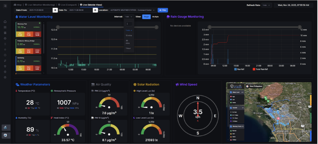
Live sensor readings, always current, always actionable
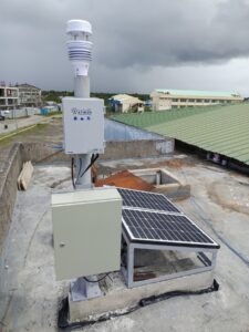
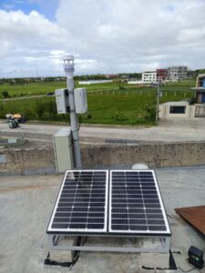
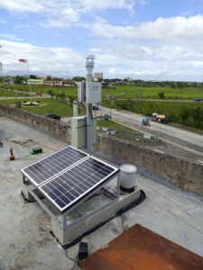
A network of rain gauge, weather, and water level sensors that continuously monitors rainfall, atmospheric conditions, and river levels to enable early flood detection and support timely, data-driven response.
02
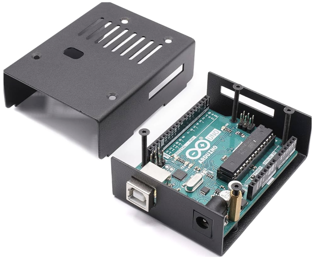
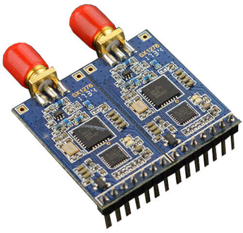
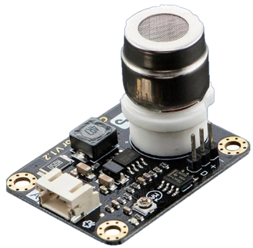
Remote terminal unit (rtu)
The Remote Terminal Unit (RTU) collects data from rain and water sensors, manages solar and battery power, stores readings during outages, and transmits data to the command center via LoRaMesh.
03
Lora Mesh Network
The LoRa Mesh Network provides long-range, reliable communication by relaying data across connected nodes, linking rain gauges, water sensors, RTUs, and the command center without requiring cellular connectivity.
04
Command Center
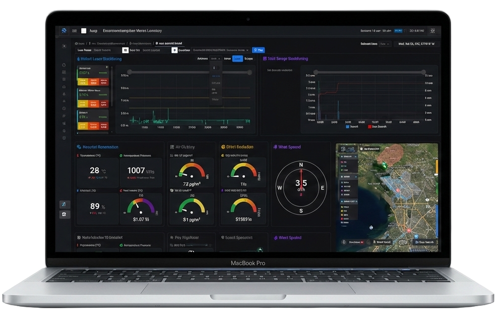
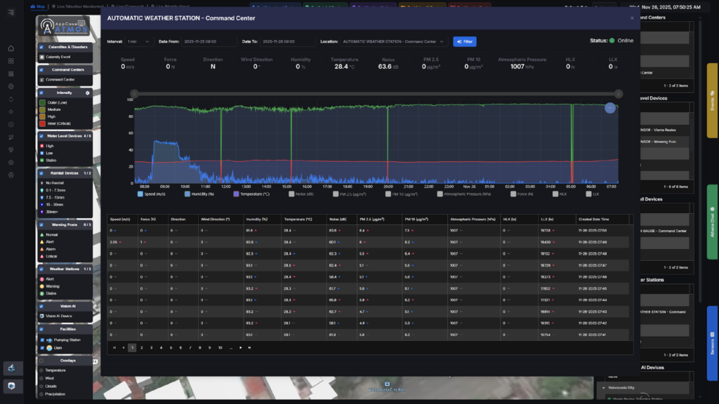
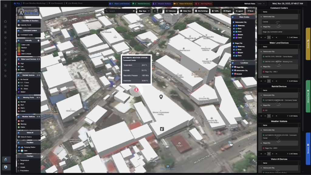
The Command Center acts as the central hub for receiving, processing, and displaying sensor data from the LoRaMesh network. It visualizes rainfall and river levels, applies alert thresholds, maps sensor stations, and distributes information to websites and warning systems.
Core Environmental Sensors
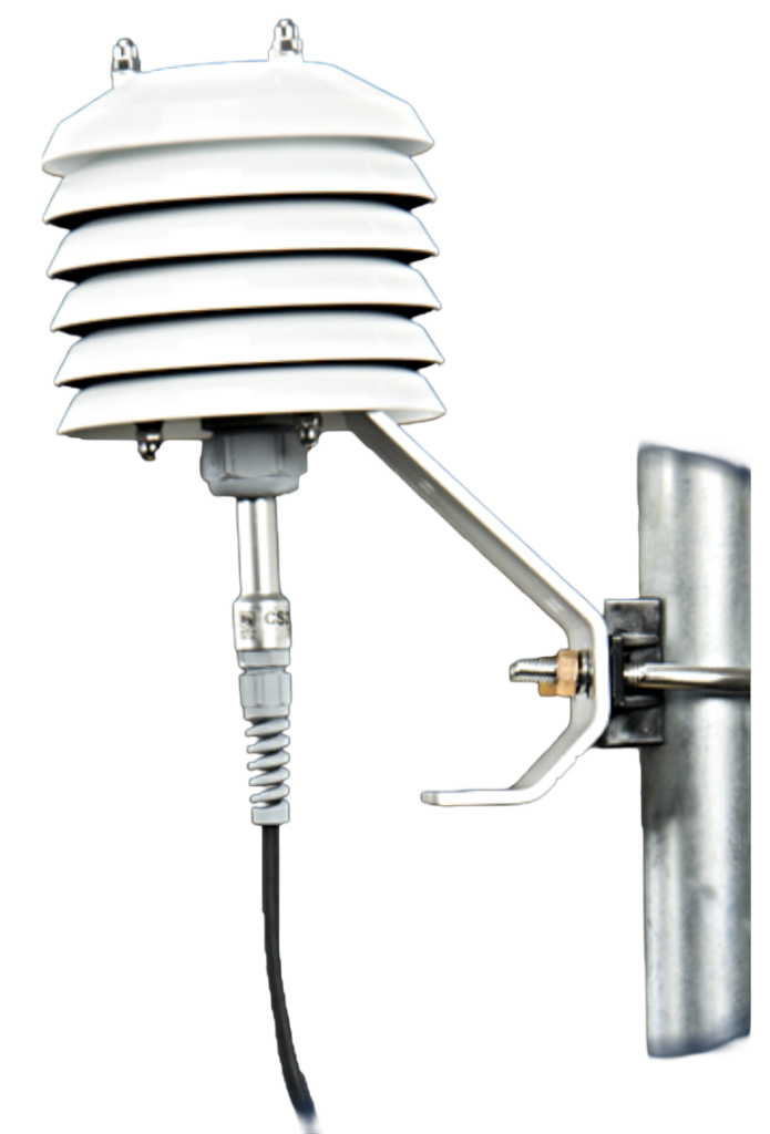
Integrated Weather Station (Ultrasonic)
The centerpiece of every ATMOS deployment. A single ultrasonic device that measures 12 environmental parameters simultaneously — no moving parts, built to survive typhoons.
Wind Speed
Noise
Wind Force
PM 2.5
Wind Direction
Humidity
Temperature
Atmospheric Pressure (kPa)
Light Intensity (LUX)
Rain
1/12
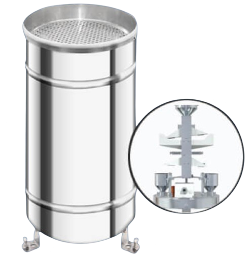
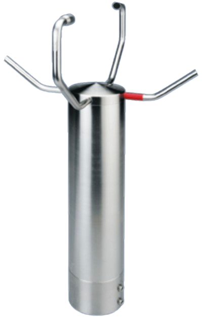
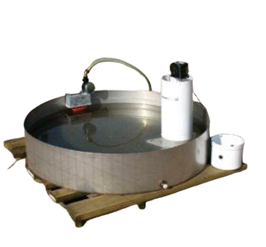
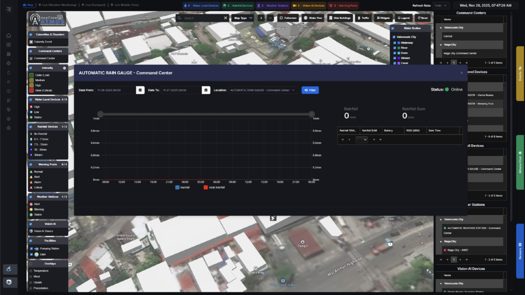
Rain Gauge
High-precision rainfall measurement with a dual-bucket mechanism for continuous, accurate data even during heavy downpours.
Size
200mm inner diameter
Resolution
0.1mm or 0.2mm
Accuracy
±2% to ±7%
Range
0–4 mm/min (max 8 mm/min)
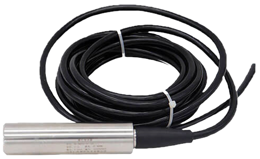
Pressure Sensor
A high-accuracy water level sensor with a customizable 0–5 m range, ±0.1% full-scale accuracy, and 4–20 mA or SDI-12 output, protected in a stilling well for stable and reliable monitoring.
Range
0–5 m (customizable)
Accuracy
±0.1% full scale
Output
Analog 4–20mA or SDI-12
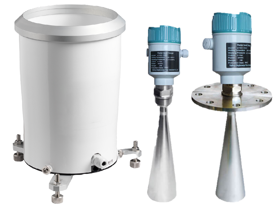
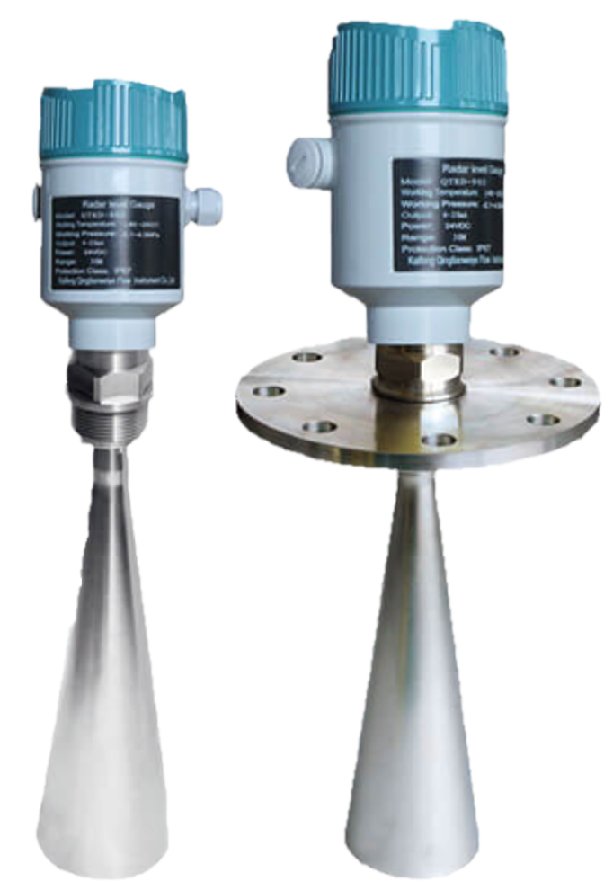
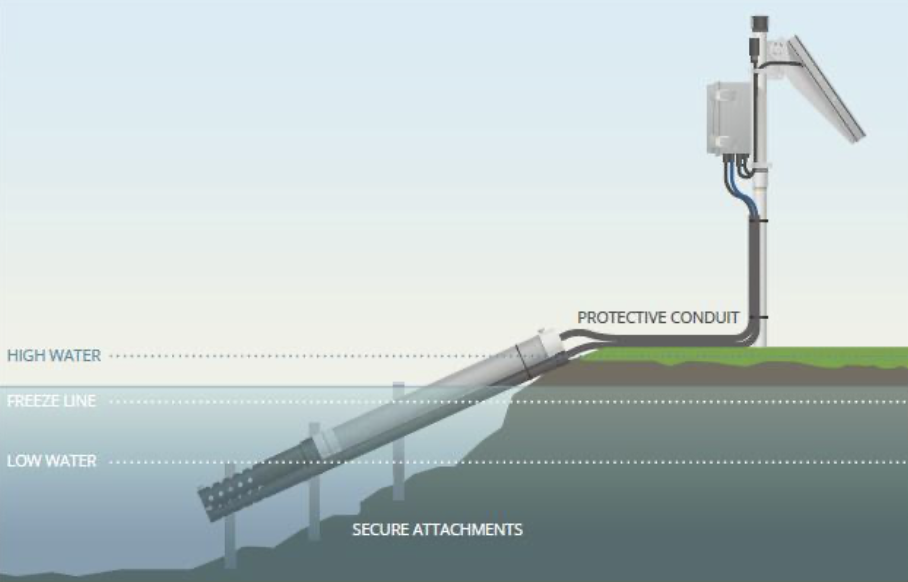
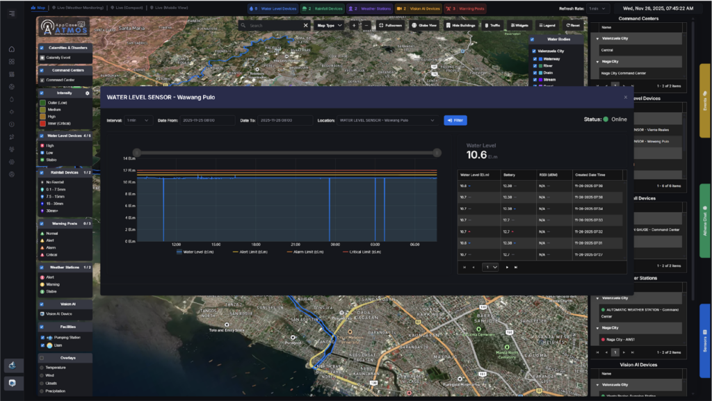
Radar Sensor
Installed downstream in rivers, water level sensors monitor rising water levels using radar- or pressure-based technology to support timely detection and response.
Range
0.3 – 20 meters
Accuracy
±10 mm
Output
RS485 Modbus or SDI-12
Power
6–24V DC, <100 mW average
Air Temperature & Humidity
Radiation-shielded sensor for accurate ambient readings. Computes heat index, urban comfort levels, and evaporation rates.
Temperature
-40 to +80°C (±0.3°C)
Humidity
0–100% RH (±2%)
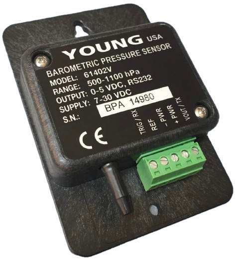
Barometric Pressure
Essential for typhoon detection and weather forecasting. Detects pressure drops associated with incoming storm systems.
Range
300–1100 hPa
Accuracy
±0.12 hPa
Uses
Typhoon detection, elevation correction
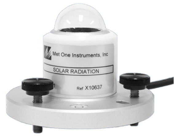
Solar Radiation
Measures incoming solar energy — critical for heat island studies, solar energy planning, and agricultural research
Range
0–2000 W/m² (±5%)
Unit
W/m²
Uses
Solar energy, heat island, agriculture
Wind Speed & Direction
No moving parts — reliable even in extreme storm conditions. Precise wind measurements for typhoon monitoring and early warnings.
Wind Speed
0–60 m/s (±0.1 m/s
Direction
0°–360° (±1°)
Evaporation Rate
Pan evaporation or sensor-based measurement of water loss from surfaces. Key for drought analysis and irrigation control.
Method
Pan evaporation or sensor-based
Key for
Drought analysis, irrigation control
CO₂ & Particulates (PM2.5 / PM10)
Monitors greenhouse gases and fine particulate matter for urban air quality assessment, climate studies, and pollution mapping.
CO₂ Range
0–5000 ppm (±50 ppm)
Particulates
PM2.5 & PM10 (μg/m³)
Important for
Urban AQI, climate studies, GHG mapping
Haze Detection
Optical haze detector that supplements PM data. Automatically alerts the public when visibility drops due to pollutant accumulation.
Type
Optical instrument
Function
Supplement to PM data
Triggers
Public visibility alerts
Soil Moisture
Monitors volumetric water content in soil — essential for drought monitoring, flood risk forecasting, and smart irrigation.
Range
0–60% VWC (±3%)
Uses
Drought monitoring, flood risk, irrigation
Water Quality Sensor
Deployed in rivers or drainage near City Hall. Supports waste discharge enforcement and ongoing river health management.
Parameters
pH, turbidity, dissolved oxygen, conductivity
Location
River or drainage near City Hall
Supports
Waste enforcement, river health
platform features
everything your lgu needs
One platform. Every environmental risk. From typhoon tracking to air quality to flood alerts. ATMOS has it covered
Typhoon & Weather Alerts
Real-time wind speed, pressure drops, and rainfall intensity alerts give your DRRMO advance warning before conditions turn critical.
Real-Time
Air Quality Monitoring
PM2.5, PM10, CO₂, and noise levels — automatically broadcast to the public when readings reach dangerous levels.
Public Health
Flood Risk & Monitoring
Water level sensors placed at rivers show rising levels hours in advance. Alert, Alarm, and Critical thresholds trigger automatic notifications.
Early Warning
Global Disaster Awareness and Coordination System (GDACS)
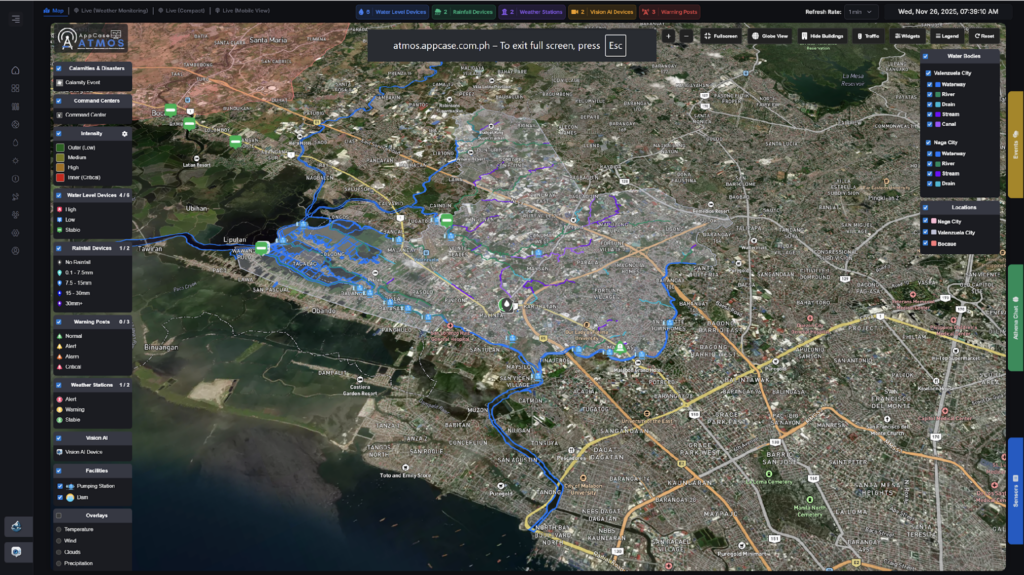
Track typhoons, earthquakes, tsunamis, and volcanic eruptions worldwide — all in the same 3D globe view as your local sensors.
GDACS
Multi-Channel Alert Dissemination
Alerts broadcast via SMS, email, web dashboard, and mobile app. Residents, responders, and executives all get the right data.
multi-channel
LoRaMesh
Works without cellular towers. Long range (2–10 km), low power, solar-compatible, and self-healing when a node goes offline.
LoRa mesh
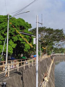
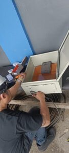
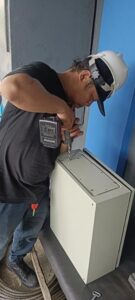
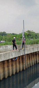
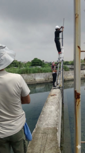
Real Deployments
ATMOS in the field
From mountain watersheds to urban river banks — see how ATMOS installations are protecting communities across the Philippines.
installation photos – Hover to pause – Nationwide Deployments
Athena AI
AI that predicts, not just report
Hover to say Hi!
Athena AI
Online
AI that predicts, not just report
ATMOS doesn't just show you data — it understands it. Machine learning runs continuously on your sensor feeds to detect anomalies, predict events, and fire alerts before your team would ever notice manually.
01
Flood Prediction – 30-60 Min. Ahead
Upstream rain data + river levels + historical patterns = early flood forecast. AI sends the warning before levels become dangerous.
02
Anomaly Detection
Sudden pressure drops, PM spikes, or unexpected water level surges are flagged instantly — even outside business hours.
03
Vision AI — Camera-Based Monitoring
AI-powered cameras monitor river flood levels and haze visibility, feeding visual alerts directly into the Command Center.
04
Athena Chat — Ask Anything
Built-in AI assistant answers questions about current calamities, sensor readings, and disaster response — in plain language.
🤖
Smarter Governance, Automatically
ATMOS AI works in the background — no data analyst needed. Your team gets clean, actionable alerts instead of raw sensor dumps they have to interpret manually.
🌏
Global Disaster Awareness Built In
Typhoons. Tsunamis. Earthquakes. Volcanic eruptions. Forest fires. ATMOS tracks all global calamities from the last 24 hours alongside your local sensor data — in a single view.
📊
Learns From Your Data Over Time
The more data ATMOS collects from your specific watershed and terrain, the more accurate its flood predictions become. It adapts to your local conditions.
built for
Who benefits from atmos
🏛️
Local Government Units (LGU)
Mayors, CDRRMOs, and disaster response teams get a real-time command center — from flood alerts to typhoon tracking — without needing a full IT team to operate it.
🏘️
Flood Prone Barangays
Upstream rain gauges and downstream water sensors give barangay officials hours of advance warning before floodwaters arrive — enough time to evacuate vulnerable residents.
🌾
Agricultural Communities
Soil moisture, solar radiation, and rainfall data help farmers make smarter irrigation decisions, protect crops from extreme weather, and plan harvests more accurately.
Atmos Demonstration
see atmos live!
Atmos Dashboard Preview
Atmos site Installation
ATMOS dashboard preview
Global Disaster Awareness and Coordination System (GDACS)
What it shows
Real-Time Disaster Intelligence
Global Alert provides real-time disaster intelligence — typhoons, earthquakes, tsunamis, volcanic eruptions, flooding, and drought — directly inside the ATMOS dashboard.
Who's behind it
UN & European Commision
Backed by the UN and European Commission, Global Alert connects disaster managers worldwide for faster alerts and coordinated response in the critical first hours.