STREAM delivers real-time water level intelligence via AI-powered IP cameras deployed at rivers, lakes, and flood-prone zones across the Philippines — enabling faster LGU response when it matters most.
Flooding remains one of the biggest threats to lives and property in the Philippines. STREAM provides real-time monitoring and alerts using advanced AI analytics on live camera feeds.
Why STREAM
01 //
Real-Time Intelligence
Vision AI continuously analyzes live video to detect rising water levels, floating debris, and critical conditions the moment they occur.
02 //
Instant Alerting
Automated alerts notify LGU officials when flood thresholds are breached, enabling rapid response and evacuation decisions.
03 //
Remote Coverage
Solar-powered, off-grid systems ensure 24/7 operation at rivers, lakes, and flood-prone zones — even in the most remote barangays.
04 //
Visual Documentation
Automatic snapshots at set intervals and during flood events provide timestamped visual evidence for DRRM review and reporting.
05 //
Vision AI Core
Advanced object detection reads flood gauges and water edges automatically, eliminating the need for manual observation stations.
06 //
Built for LGUs
Intuitive dashboards, hands-on training modules, and seamless integration with existing DRRM workflows and early warning systems.
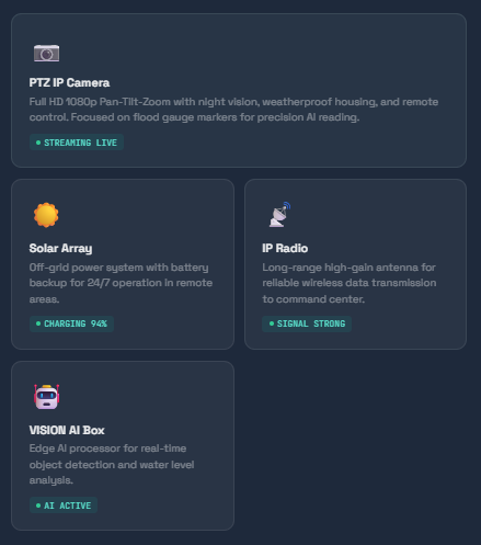
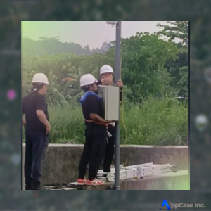
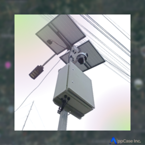
— SYSTEM COMPONENT
Built for Field Reliability
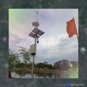
STREAM integrates cameras, AI analytics, wireless transmission, and command displays to form a complete situational awareness system for LGUs.
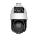
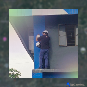
PTZ IP Camera with Flood Marker Focus
High-resolution cameras capture rivers and floodplains. Operators remotely zoom into flood gauges or observe wide areas.
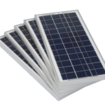
Solar-Powered Off-Grid System
24/7 operation in remote areas guaranteed with off-grid solar systems powering cameras and radios continuously.
IP Radio Transmission
Live camera feeds are wirelessly transmitted to the control center using long-range IP radios with high-gain antennas.
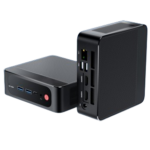
VISION AI Analytics Box
STREAM is the VISION AI box that performs real-time object detection, snapshot capture, and water level analysis from video feeds.
— DATA FLOW
From Riverbank to Command Room
STEP 01
Camera Captures
PTZ camera streams 24/7 live footage of rivers and gauges
STEP 02
AI Analysis
VISION AI detects water levels, markers, and objects
STEP 03
Transmission
IP radio sends data wirelessly to the command center
STEP 04
Dashboard
Live feed and alerts displayed in command center
STEP 05
LGU Action
Officials notified and emergency response triggered
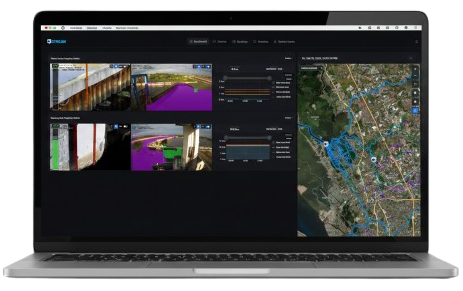
— DASHBOARD
Command Center Overview
Live video, AI snapshots, alert status, water level graphs, and interactive sensor maps — all in one interface.
NORMAL
ALERT
CAUTION
Live Camera Feed
Status Alerts
NORMAL0.8m // within safe range
14:32
NORMAL0.6m // within safe range
14:15
Current Value0 EL.m
Last Update--
❚❚
10 mins
×
Interactive Sensor Map
×
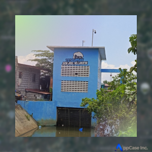
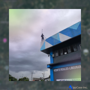
— CASE STUDY
In the Field
Real Deployment, Real Results
Deployed STREAM to monitor river levels near residential areas. During a recent flooding event, STREAM captured the situation in real-time and triggered emergency protocols automatically.
• PTZ Cameras Installed
Deployed along Bocaue River banks for continuous coverage of residential flood zones
• AI Detects Rising Levels
Vision AI identified critical water level rise before manual detection was possible
• Emergency Alerts Triggered
LGU officials automatically notified at 2.0m threshold — response initiated within 30 seconds
• Event Fully Documented
Automatic snapshots captured the entire flood event for post-disaster review and DRRM planning
— BENEFITS
Why LGUs Choose STREAM
✔ Verified
Real-Time Water Level Detection
AI-driven detection with sub-meter precision from any camera angle, updated continuously from live video feeds.
✔ Verified
AI-Driven Alerts
Automated notifications the instant flood thresholds are breached — no manual monitoring required.
✔ Verified
Remote Reliability
Solar-powered off-grid systems keep every station operational even in the most isolated terrain.
✔ Verified
Visual Evidence with Snapshots
Automatic timestamped snapshots at set intervals and upon flood detection provide indisputable visual documentation for DRRM reports and post-disaster review.
✔ Verified
DRRM Support
Complements sirens, evacuation routes, and communication tools to form an integrated disaster response system.
✔ Verified
DRRM Integration
Works alongside existing early warning systems and communication infrastructures with minimal configuration.
— ROADMAP
What's Next for STREAM
Planned upgrades will make STREAM smarter, more predictive, and even easier for LGU teams to operate.
User Training & Familiarization
• PTZ camera control, zoom operations, and preset positions
• Dashboard interpretation and alert level management
• Emergency response protocols and escalation procedures
• AI snapshot review and event documentation workflows
• Integration with barangay DRRM plans and communication trees
Planned Upgrades
• Machine learning for predictive flood modeling before events occur
• Integration with rainfall radar and satellite data streams
• AI detection of floating debris and channel obstruction
• Multi-site dashboard with regional flood mapping layers
• Mobile app for LGU field responders and barangay captains
Ready to Protect Your Community?
Join the LGUs already using STREAM to safeguard lives and property from flooding — before the next disaster strikes.